So, with familiar ground awaiting me at the end of an unfamiliar hike; and a convenient, approximately 12.5 mile segment that involved minimal roadway connections of trail leading south towards the park, it seemed like a great first proper trail outing. I had been trying to talk a couple of friends into accompanying me on this sort of trip, one of them for over a year now, but while I got a few casual expressions of interest, nobody bit seriously on the opportunity, and I decided I'd do the hike solo with a little assistance from Bob. He was amenable, he hardly needs an excuse to get out into the woods and enjoy some nature, and it seemed like my interest in backpacking had rekindled his own interests in the same.
I waited for the weather to be right, WI's been on something of a rollercoaster this spring. I hammered out the itinerary that you've already seen. And I worked up the gear inventory, though most of that was just a matter of going through what I had in my bag already. After a stop at a local convenience store for a coffee to go with my breakfast apple fritter, we set off early (by my standards) this past tuesday morning headed for the trailhead I had selected, at the north end of the Skunk and Foster Lakes segment. It was unusual, the official Ice Age Trail Association documents catalog and map the trail from northwest moving south and east. Yet most of the signage and structure of the trail I encountered seemed to assume you'd be moving north along the trail, coming from the south. We dropped me off in one of those field-access-driveways for a farmer's field across from the Skunk and Foster Lakes trailhead, because the parking lot for that segment was at the south end of the trail.
Skunk and Foster Lakes Northern Trailhead

I am not normally a breakfast person, or a morning person for that matter. But I was alert and in high spirits as I started the trail. The coffee I had probably wasn't even necessary.While I began the walk with my Polar Fleece jacket on, it really wasn't long at all before I paused, stowing that in my bag. We'd figured this would be the case, but it was only in the mid 50F range as I set out, and I wanted some warmth to tide me over till I was making plenty of my own. That wouldn't take long. Though loaded down with supplies, water and gear, my pack's weight soon became unnoticed. I attribute this in part to having such an excellent fit with my pack, and in part to human adaptability.The trail through here was in pretty good shape, only a few dead trees had fallen across it's path. The segment was hillier than I had expected, even though I'd looked at a topographical map. Numbers and shading on paper don't really translate super well to what you actually experience.
The horseshoe shaped loop I started in wound past several lakes, taking me up and down hills, and eventually on a path down between two lakes. If this hadn't been the start of my day, it would have been possible, though not necessarily ideal, to filter water from these lakes. The main reasons why I wouldn't be eager to is that they're mucky bottomed lakes and to get to water deep enough to filter from, I'd probably have to go barefoot and wade in. Not enticing in the Wisconsin spring. Having to deal with feet covered in cold mud would not be conducive towards making miles on the trail. Fortunately I was loaded with ample water (which probably made for a good deal of the weight I was lugging.) Two one-liter bottles of nicolet artesian water from the grocery store rode in my bottle holsters, and my pack's hydration sleeve had my 50oz (1.5l) camelbak. All told, I was carrying just roughly under a gallon of water with me.
The Horseshoe through the Skunk and Foster Lakes eventually took me over a little bridge and at this point, I could have taken a blue-blazed side trail to the parking lot. I actually thought from the map, that the lot would be where I exited. I'd have been better off exiting there, but I wanted to stick to the yellow-blazed main trail indicatiors, so I followed the trail across the bridge, and down a mostly vestigial jaunt through the woods. In many ways, this was a bridge to nowhere, and it added empty yards to the distance of my hike, for it soon spat me out at a road. I was uncertain which way to head, and rapidly became glad that I had stashed my new compass and a second copy of my map in the almost vestigial pockets of my hip belt. While I would certainly still appreciate larger pockets on my belt, I am forced to upgrade my opinion of them slightly. They are exactly the right size to hold my compass and map. I would not be unhappy if they suddenly accommodated more, but I no longer see them as ENTIRELY useless.
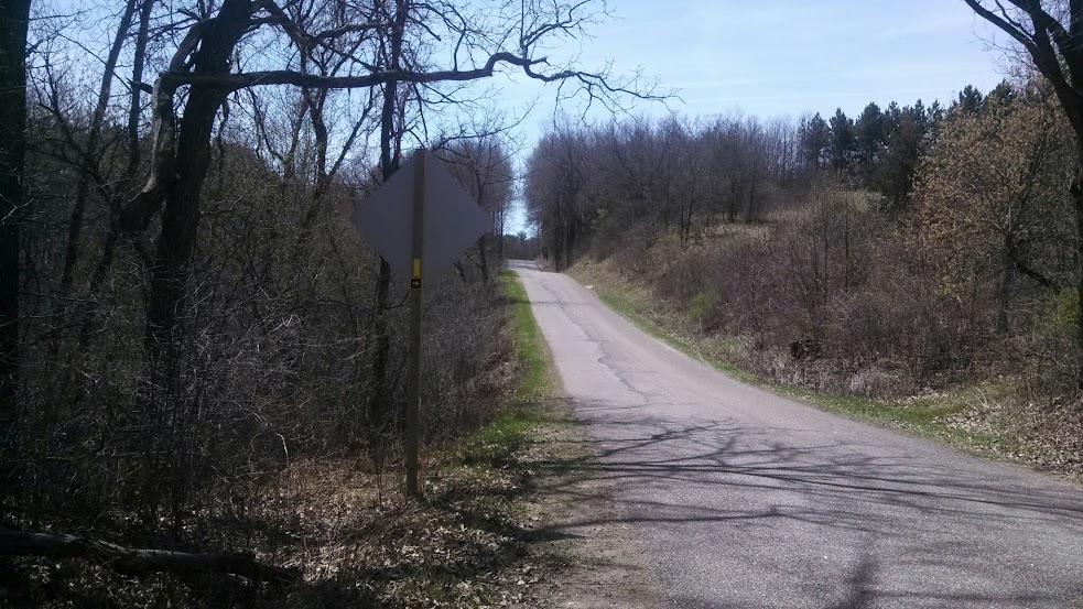
After getting my bearings and reckoning how the map translated to reality, I went left along the road, towards a nearby intersection. The parking lot would have led me more directly to this intersection, but it was too late for that. I started down Indian Valley road, and checked the map a couple times to make sure I was headed the right way. The woods flanking the road gave way to open fields, and there was some manner of home, you could possibly even call it a farm, though if it was, they must have had horses, rather than crops. Passing this place became the first eerie moment of my journey. I heard a noise that words can not really do justice. It was part baying hound, part dying moose, and yet, not really exactly like either of those things. I quoted a line from one of my favorite Radio Plays "The House in Cypress Canyon" and muttered "Some Tomcat!" (in the radio play, a young couple moves into a house and begins hearing a strange animal cry from outside. The husband supposes it must be a Tomcat in the brush, but then it grows louder). Then, as I move along the road, keeping an eye out for the next trailhead, I hear it again. Keeping my trekking poles at the ready, I increase my pace as this cry periodically issues from the woods behind me and to my right.
Indian Valley Rd, right about where I heard the noise

I reentered the wilder parts of the trail. This time, rather than a state natural area, I found myself on private property. Note those microwave towers in the above photo of Indian Valley Rd. I had the urge to put some ground between that odd howl(which to my dismay had grown louder as I approached the trailhead, though still from the same direction it had originated) and myself so I did not dawdle through the woods here. Unfortunately, as you can see from the above photo, there's a bit of a rise here, and the trail goes right up it. Making haste through the woods, I pushed myself a little too hard on the incline and quickly redlined myself. I had made it to the top of the rise however, and I took my first break, laying down on the ground, head against my pack while I rehydrated and caught my breath. I'd made it through the woods to a clearing though. Home to the aforementioned microwave towers.
I heard no further howls, no slavering beast upon my heels. But with my breath caught and the sound of some tractor or construction equipment operating near by to ruin the peace and quiet, I moved along. As I descended the other side of the rise, glad for my poles to steady my descent, I did see a bit of bone. Some manner of hip bone fragment, though I am nowhere near qualified to identify the source. Some unfortunate animal? a crumb left by the Beast of Indian Valley Road? Who can say? I moved onwards.
The trail descended further, through some more trees, past a trailer, and to a road crossing lined with boulders. Continued on the other side of the road, the end of the Skunk and Foster Lakes segment wound through some of the most poorly demarcated trails in the area I hiked that day. For a time, the trail was less an obvious path, and more a series of trees bearing yellow blazes that I puzzled my way along. Around here, it merged for a time with ATV trails and spat me out alongside a farmer's field. It felt a little odd, walking through this farm but I was glad that they permitted hikers to cross their land there. The trail continued through their fields, past their cows and barns, around some equipment they'd parked, across a road through two more fields, and ultimately along the railroad tracks that ran parallel to Hwy 10.
Despite not accounting very well for terrain, I was roughly on time as I crossed Hwy 10 and ended the SAFL Trail Segment. I'd thought there was going to be a parking lot on the other side of the highway where I could make some lunch. There was nothing there but a couple signs and some dry grass. I headed onwards down the connecting road, and had a cliff bar to tide me over as I began the Waupaca River segment of my hike. (To be continued!)
Highway 10, End of the Skunk and Foster Lakes segment

Follow the, follow the, follow the, follow the, follow the yellow blaze road
great trail again...like the tomcat cry and the bone fragments
ReplyDeleteThanks! I find myself both wishing I knew what that noise WAS, and glad that I didn't find out.
DeleteThanks! I find myself both wishing I knew what that noise WAS, and glad that I didn't find out.
Delete