Showing posts with label Backpacking. Show all posts

Tuesday, December 1, 2015

Restless Wilderness' End of 2015 Budget Gear List

Backpack: Jansport Klamath 55R
Store: REI Outlet $107.73 
Weight: 57oz

My previous gear list had a phenomenal deal on the Katahdin 50L pack. The Klamath is the katahdin's external frame brother. Yes. Let me be clear. the Jansport Klamath packs are External Frame. As always the BEST things you can do for a backpack are to try them on with a load before you buy, and check the REI Garage Sales, but I can't really link to that on a blog.

The Klamath 55R is twice the price that the Katahdin 50, and since it's a 2014 closeout, I'm surprised that it's still so pricy. But, it's the cheapest pack I've been able to find at the moment. If you MUST buy a pack right now and you're on a budget, this looks like one of your best options. Yes, I did see smaller packs for lower prices, but I'm loathe to recommend lower than 50 liters for multi-day trips.

If you can hold out until say, Late Febuary, you might be able to get a better deal on things, or a newer revision. Personally, since it's winter, I feel like I can afford to wait. But, if you're gift shopping or looking to outfit yourself before spring rolls around, you could do worse than this.


Trekking Poles: Cascade Mountain Cork/Flip Locks
Store: Amazon $47
Like I said here Trekking Poles are a must. Cork is good. Flip-locks a must. $47 is hard to beat.


Tent: Stansport "Scout" Tent
Store: Amazon $23.88 
Weight: 60.8 oz

I'm just enamored with the idea of this tent. It's remarkably cheap and weighs less than my Passage2, and it reminds me of the LL Bean backpacking tent that my dad bought decades ago. You could shave off even more of the weight by leaving the poles at home, and using your trekking poles in their place. I think I'd rather be in my Passage2 if it were raining cats and dogs out, but this should keep the raccons from cuddling with you and hopefully keep you dry outside of monsoon season.

This is the same tent that was on the last iteration of my list, and I don't think you're going to find a tent cheaper than this. If you want to go cheaper and lighter, we start talking make-your-own gear shelters out of Tyvek and Dropcloths. which IS an option, there are ultralighters who do entire scenic trails with little more shelter than that.


Sleeping Bag: Kelty Cosmic Down 41 Long
Store: Amazon $87.17
Weight: 35oz

Same essential bag I recommended last time, but now for cheaper!  Where weight and warmth are a premium, Down is a must. Kelty's Cosmic Down line is a great entry level option, and my own hiking bag is a 2014 closeout Cosmic Down 20 Long I picked up at Scheels Sports in the local mall. I can vouch for these bags, and the 20 is almost TOO warm for me, particularly in the summer. the 41  ought to cover most people's three-season camping/hiking needs.


Sleeping Pad: Blue Closed Cell Foam Pad
Store: Wal-mart for roughly $10
Notes: Cannot find online
Weight: 7.5 oz

For whatever reason, Wal-Mart's online selection and their camping section at every store I've been to, have been in no way similar. I can't in good conscience recommend any of the ones I see on Amazon. I use one of these myself. My car camping self inflating insulation pad is a lot nicer to sleep on, but it's far far more bulky.


Item:  Bacon Grease Strainer used as Cooking Pot
Store: Amazon $9.69 
Weight: 3 oz (w/o strainer part)
Notes: Lightweight and Inexpensive, I keep seeing this popping up in people's gear lists. Up a few cents from before, but still quite affordable. Bring a pot lifter


Item:  Pot Lifter
Store: REI $1.93
Notes: Goes with the Grease Strainer. Needs a handle. Marked down since last time! (might be clearance now)


Item:  Canister Stove
Store: Amazon $7
Notes: Same stove I'm using. Wholly endorse this. Highest price to satisfaction ratio of almost anything I own.
Weight: 3.7 oz
Weight: 2 oz


Item:  Sawyer Mini Water Filter
Store: Amazon $19
Notes: Save on shipping by buying locally if you can find it for a comparable price. If you're in appleton, try the east side wal-mart. Consider pairing with Aquamira or Potable Aqua for thorough purification.
Weight: 6.4 oz


Item:  10L Food Bag
Store: REI $9
Notes: Combine with Paracord, Carabiner and Stick and you can use the PCT Hang on the bag and prevent Yogi from getting into your pick-a-nick basket.
Weight: 1.7 oz


Item:  Morakniv Companion
Store: Amazon $16
Notes: a basic, reliable, inexpensive knife. If you want something heavier duty, I recommend the Buck 110 folding or Buck Pathfinder 105 fixed blade knife.
Weight: 4.1 oz


Item:  Sea to Summit Alphalight Spork
Store: REI $9
Notes: I'm still quite happy with mine. Puts up with a good deal of my abuse with nary a sign of wear.
Weight: 0.4 oz

Tuesday, May 19, 2015

Trip Plan: Ice Age Trail - Harrison Hills Section

Stage 0: Pre-trip

Pack Thursday Night. Google says 2h9m to reach trailhead. Wake at 4:20am, stop at Kwik Trip, depart Appleton by 5:00am

Stage 1: Solo

[T = 7:10 AM]
Bob drops me off at the Harrison Hills Trailhead. Hike Eastbound through the Alta Springs Fishery area,  and down the first leg of the Harrison Hills Ice Age Trail Segment. Topographical Maps indicate that this will be a much hillier trail than SAFL/WR/HCSP.  Highlights of this segment of trail include a sandy beach I'm told sits at the riverbend early on and an unnamed lake suitable for topping off water supply. Meet Bob at Turtle Lake Road Lot.

Luke's Trail Snacks: Chocolate Covered Raisins, Yogurt Pretzels, 1 of 4 Clif Bars

Estimated Segment Length 3.7 miles
Google Estimated Time To Complete: 1h17m
My Estimated Time to Complete(@2mph): 1h 51m
Optional Filtering/Break/Food buffer: 30m

Completion window T+1h 17m  to  T+2h 20m / 8:27am to 9:30am


Stage 2:  + Bob

Resupply from Car if Necessary, Add Bob to the Party, Continue down Second Harrison Hills Trail Segment. Keep on watch for a good lakeside or hilltop lunch spot, and stop for lunch between 11am and 1pm. Continue Eastbound down the trail headed for Lookout Mountain. Lookout Mountain is the highest place on the Ice Age Trail and somehow, despite the trail segment being named "Harrison Hills" the topographical map indicates far more up and down than I had been picturing. CalTopo doesn't overlay where the trail GOES, but I suspect it does more up and down than around.

Keep an eye out for good camping area along this stretch of trail, but plan on camping E of Lookout Mountain. Lookout Mountain will also serve as an exit point should either hiker require extraction.

Luke's Lunch: Knorr Mushroom Rice & Pink Salmon
Luke's Snacks: Finish Chocolate Covered Raisins, Finish Yogurt Pretzels, 1 of 3 Remaining Clif Bars

Estimated Segment Length: 4.4 mi
Google Estimated Time to Complete: 1h:30m
My Estimated Time to Complete(@2mph): 2h 24m
Lunch Break: 45 min
Filter Break: 30 min

Segment Completion Window: Seg+2h 45m to Seg+3h 39m
Total Completion Window: T + 4h 2m to T + 5h 59m / 11:12pm to 1:09pm


Stage 3: Find Camp

Continue East, looking for a good camping area. Earliest point likely around 2.1mi in @ Fox Lake until area parallel to Fish Lake 4.4mi in. Not only will we have covered most of the trail length at this point, but we will be nearing our physical limits. (at furthest point we will have traveled 8-12 miles of what passes for high relief terrain in wisconsin. ironically, high relief terrain does the opposite of what it sounds like.)

Luke's Snacks: 1 of  2 Remaining Clif Bars, Fruit-Based Item
Luke's Dinner: Mountain House Roasted Chicken Breast w/ Mashed Potatoes (Add Dehydrated Onion to potato, bring BBQ Sauce Packet for Chicken), Backpacker's Pantry Dark Chocolate Cheesecake. Aleve Painkiller.

Furthest Camp Point 4.4mi
Google Estimated Time to Complete: 1h 33m
My Estimated  Max time to complete: 2h 24m
Dinner Time: 1h
Filter Time: 30m

Segment Completion Window: Seg+2h 30m to Seg+3h 54m 
Total Completion Window: 6h 32m to 9h 53m  /  1:42pm to 5:03pm


Stage 4: Set Up Camp

Make Camp and relax! It's been a long day, I'm sure! Enjoy the stars and hopefully the sound of Wolves.

Luke's Snacks: Whisky (hopefully this'll help with that whole sore leg thing!)


Stage 5: Wake, Breakfast, Break Camp, Depart.

Wake by 8am and make breakfast, tear down camp and head Westbound down Ice Age Trail aiming for 9am trail departure.

Luke's Breakfast: Mountain House Granola & Blueberries, Aleve Painkiller
Luke's Snacks: Kashi Fruit and Nut Trail Bar

Distance to top of Lookout Mountain: 4.4mi
Google Estimated Time to Complete: 1h 33m
My Estimated  Max time to complete: 2h 24m
Filter Time: 30m

Segment Completion Window: Seg+2h 3m to Seg+2h 54m / 11:03am-11:54am


Stage 6: Return to Vehicle

Head down from Lookout Mountain, keeping an eye out for a lunch stop location. Stop for lunch and head for car.

Luke's Snacks: 1 Remaining Clif Bar, Anything Extra
Luke's Lunch: Mountain House Lasagna w/ Meat Sauce

Distance to Parking Lot: 4.4mi
Google Estimated Time to Complete: 1h30m
My Estimated Time to Complete: 2h24m
Lunch Time: 45m

Segment Completion Window: 2h 15m to 3h 9m
Total Completion Window: 4h 18m to 6h 3m / 1:18pm to 3:03pm

Return home to Appleton for dinner, should return around 5pm

Wednesday, May 13, 2015

Cheap & Light Gear List Suggestion

Sample Light and Cheap Base Gear List:

Item:  Jansport Katahdin 50L Backpack
Store: Campmor: $50
Notes: This is as inexpensive as you're going to get brand new. The Jansport pack seems a serviceable pack for someone who doesn't want to invest in a high-end pack.As always, the most important factor with a pack is that it fits *you*. Consider checking out the REI Garage Sale instead. Last time I was there, I saw a bunch of packs.
Weight: 33 oz

Item:  Alpika Taiga3 Tent
Store: Ali Express: $61 shipped. 
Notes: Untested chinese made tent aimed at the russian camping market. Remove the included poles, Replace with adjustable length Trekking Poles. Picked this one as it reminds me of Bob's old tent. Or go prowl the next REI Garage Sale and hope you find a good deal on a tent. Seriously, you're probably much better off trying for a deal at REI.
Weight: 77.6 oz

Edit: Forget that!
Item: Stansport "Scout" Tent
Store: Amazon $23.88
Weight: 60.8 oz

Item:  Kelty Cosmic Down 40 Sleeping Bag
Store: Amazon: $104
Notes: You can spend a little more to get the Kelty Cosmic Down 20, which worked quite well for me, but you can shave off a little money by going with the Cosmic Down 40.
Weight: 31 oz

Item:  Closed Cell Foam Pad
Store: Wal-mart $10
Notes: Cannot find online
Weight: 7.5 oz

Item:  Bacon Grease Strainer used as Cooking Pot
Store: Amazon $9.41
Notes: Lightweight and Inexpensive, I keep seeing this popping up in people's gear lists.
Weight: 3 oz (w/o strainer part)

Item:  Pot Lifter
Store: REI $4
Notes: Goes with the Grease Strainer. Needs a handle.
Weight: 2 oz

Item:  Canister Stove
Store: Amazon $8
Notes: Same stove I'm using. Wholly endorse this.
Weight: 3.7 oz

Item:  Sawyer Mini Water Filter
Store: Amazon $17
Notes: Save on shipping by buying for $19 if in appleton. Consider pairing with Aquamira or Potable Aqua for thorough purification.
Weight: 6.4 oz

Item:  10L Food Bag
Store: REI $9
Notes: Combine with Paracord, Carabiner and Stick to hang the bag and prevent Yogi from getting into your pick-a-nick basket.
Weight: 1.7 oz

Item:  Morakniv Companion
Store: Amazon $16
Notes: a basic, reliable, inexpensive knife. If you want something heavier duty, I recommend the Buck 110 folding or Buck Pathfinder 105 fixed blade knife.
Weight: 4.1 oz

Item:  Sea to Summit Alphalight Spork
Store: Amazon $12
Notes: good for getting to the bottom of mountain house bags without slopping all over your knuckles.
Weight: 0.4 oz

Base Gear Weight/Cost: 157.2oz / $263.88

You will also need:

Simple First Aid Kit - Recommend something basic, small bandages and anibiotic ointment. Ducttape, Painkiller, and Allergy pills

Clothing & Storage -  Recommend among other things a cooling shirt, convertible pants, lightweight wool socks, compression bag. Stay away from cotton.

Expendables such as Food & Gas - Recommend Mountain House Entrees, Backpacker's Pantry Desserts, Knorr Rice and Salmon Packets. Also obtain some energy or candy bars, trail mix or other snack food to keep energy and morale up. Other expendables include gas canisters for around $5 each.

Boots or Trailrunners - Footwear is an intensely personal choice, Personally I prefer a boot, but there is a growing school of thought that prefers the lightest footwear they can field.

Trekking Poles - If you're not using them as tent poles, try grabbing ski poles from a garage sale. If you are and need them adjustable I recommend the REI Traverse series.

Headlamp - Just pick up a $10-20 headlamp from wal-mart or a hardware store.

Compass and Map

This is not a comprehensive list to give you everything you'll need. But starting with all this would get you out on the trail for a minimum of cost.

Monday, May 11, 2015

Backpacking: Why I'm Doing This.

So, those of you who know me (and I know many of you have for some time now) might find yourself wondering why I of all people am getting so dedicated to what is essentially repeated, exhausting, constant activity and exertion. Others of you might already know, or might know in part. If nothing else, this should help fill in the gaps for you. I know that if any of my old gym teachers were to happen upon this blog, and somehow recognize me that their reaction would somehow resemble the 'choosing the wrong grail' deaths from Indiana Jones. I am not a person renowned for activity or athleticism. I do however love the outdoors. Those of you who don't see my obsession with backpacking as unusual are probably thinking of my love for camping and the like, and not focusing on how much walking is really involved.

And it's true. I've always had a very difficult time with more traditional sports and gym activities and the like. I'm not fast on my feet. Not for very long, anyway. My legs have always been long, and my tendons not quite long enough, this has always made it a challenge to move fast for long without it getting painful. Never been a runner at all. I can recall a few instances where sadistic gym teachers refused to accept my 20 minute mile, and cruelly put me through it again. No. I'm still not over it. Yes, it was in like... 5th or 6th grade. No. I haven't forgotten having to do it. Nor have I forgiven whatever neanderthal had nothing better to do than collectively waste our time with it. So why walk all day long? Well, Walking's a different story! I don't have to go fast, I just have to keep going.

This all takes root in a ski accident the better part of a decade ago. Fell at the end of the season, and snapped parts of my tibia off. Now they're bolted back on with Titanium. Go Cyborgs! But, getting back to some semblance of functional after that necessitated a lot of working out. The whole thing just drove home over and over again how little I cared for exercise for exercise's sake. Despite being a hedonist at heart and absolutely loathing what a painful, unpleasant experience it is on a treadmill, or lifting weights or riding an exercise bike, the hardest part of it is the banality. I'm Extremely ADD, and I have no love for painful things, but compared to how I feel about boredom, it makes me look positively masochistic. Going to the gym is an incredible challenge for me. The actions performed there are dull and repetitive and performed in a relatively sterile and unengaging environment. Even worse, they're painful and grueling. This prevents me from my usual solution, escaping into daydream or entertainment media. I just can't engage with it, and escape into netflix, music, or television when my body keeps reminding me that it's there.

I forget where I read it, but I know it gets discussed. If you want a fitness program to be effective, it can't just be a thing you do for awhile and then stop. You'll just backslide. No, it needs to become a way of life. And, I'm still me. I don't want to subscribe to most of the fitness-oriented ways of life. I don't want to become one of those guys with 26.2 stickers plastered all over the back of a subaru. I don't want to constantly talk people's ears off about crossfit. I don't want working out to become my life. Theres too much... saccharine and testosterone and motivational posters that have no effect on me floating around in there. I can't make that my life. I could pretend for awhile, but I'm no good at living lies.

Then we get the winter of 2013/2014. I don't know how it went where you were, but in Wisconsin it was one of the least pleasant winters we'd had in awhile. Constant assaults from polar vortices and a winter that just would not die left me rabid with cabin fever. I put a lot of effort into collecting all my old camping pictures, contacting friends for albums that had long since vacated their original homes on facebook, and tossing them all on my server. Prowling the outdoor-oriented sections of Reddit, obsessing over gear. At the time, I was still pretty focused on the Car Camping thing too. But then I stumbled on some videos. Outtake reels from some through-hiker documentaries.

Enchafe The Brutality was the first. Followed by Coloradon't. Then Roaming Wyoming and The Last Best Takes. All of them, outtakes from a northbound hike up the Continental Divide Trail. I watched them. Rewatched them. Devoured everything else on Team Bad Wizard's Youtube Channel. I wanted to do this. I wanted to go on adventures like these. Still thinking about getting their documentaries, but at $40/ea, I feel weird buying DVDs when I bought a hammock for $30. I feel like gear ought to come first in my budget. I haven't stopped watching videos of hiking stuff either. I really like what they did in this one, Halfway Anywhere's Three Second Thru Hike of the PCT. "Mile, Mile and a Half" on Netflix, that sort of thing.

One thing I noticed in these videos? Through Hiking works up a monster appetite. These people were devouring whatever they could get their hands on, and still staying in shape. This appeals to the glutton in me. I've heard tale of a challenge where halfway through one of the major trails, there's a general store. Legend has it that through hikers attempt to devour a whole box of icecream there. I don't necessarily want to consume that much ice cream... but being able to do so without worry would be awesome.

So here we have it. Here's a lifestyle I can get into, actually live for this thing that'll get me out there and active. Something I don't have to force myself into doing. Something that looks like it can build quite the bond with your fellow hikers. I don't need motivational sayings, or a pep rally. I don't need a training coach or an armband for an ipod. Hiking isn't a repetitive, rote action done solely for the end result, no, it's rewarding in and of its self. Going on a hike is it's own reward, and it's constantly rewarding! If it's anything like car camping, even the unpleasant parts will be rewarding, as stories of what you've endured or as experiences to learn from.

And it's outdoors! I might struggle to complete an entire hour on the treadmill, but I'll tell you, my segment hike of the Ice Age Trail was 200x easier than that hour on a treadmill. I walked 4 times as far, through much tougher terrain but time flew past like a rocket. My love for the outdoors anesthetized me from most of the unpleasantness of the exertion. I was seeing new places, doing new things, testing gear out. I was not for a single second bored on my hike. I was exhilarated, confused, overtaxed, thirsty, hungry, happy, amazed, sore, frustrated, surprised, in pain, and relieved to reach my campsite... but not once was I bored. Not once did I want to quit.

Also it involves gear! Not only do I get to hunt for my own gear, but if I have any hope of talking friends into joining me, I'll probably need to find them the best, cheapest options so they're equipped to join me. (none of them seem to be taking it serious yet, so we're hoping for next year). I thrive on one, being well equipped for things, but also two being able to make recommendations to others. Just the other day a poster on Reddit was asking what people thought of a $50 50L backpack being sold by wal-mart. I happened to be in one of the local wal-marts and I put it on, sent them my impressions of it (it was way too small for a 6'2" 250lb person, and it felt cheap compared to the Jansport Katahdin 50L which can be had for virtually the same price)

Yeah. This is my way of getting in better shape without lying about who I am. It's about getting out into the outdoors and branching out from car camping. It's about gear obsession and cabin fever. And I'm doing this blog because I don't have enough ears to chew about it. There aren't any active IRC communities I can find. I haven't been able to sell people on joining me yet. I keep forgetting to get in touch with a local meetup group focused on it.

And now you know why.

Wednesday, May 6, 2015

Trip Report: Ice Age Trail Hartman Creek Segment

The final leg of my journey, wound up being the most difficult to complete in some ways. I'd not gone excessively hungry through my journey, I wasn't shambling along with a growling stomach beset by hunger pangs. But I think I would have benefited from bringing more food. Even with a clif bar to tide me till I found a lunch spot, even with stopping for a mountain house lunch, and even with the second clif bar I'd had just before this segment, I was starting to feel the effects of my day of exertion. My energy levels were down, my frustration was rising, and I was starting to make mistakes. It wasn't all a matter of food though, the pain was starting to add up. 

Even with my carefully selected boots and socks, and I'd even switched to fresh socks just before this segment began for increased comfort that 2.7 mile road leg on my last segment took it's toll on me. Asphalt is a lot harder on your feet than dirt is. So when my course took me into the piney sandy loam in the Hartman Creek area, it was a relief. So much so that I took this picture


That's the other thing! I've got so many fewer photos from this stage of the trip. Partly I was just focused on getting to the end and getting to finally sit down, but partly it didn't even occur to me. So, it was 3 miles from Hwy 54, and for half of that, I was in relatively good shape, relatively good spirits. But halfway through, I began to degrade. A day's wear on my feet which had never endured a walk more than a couple hours at a time began to show. My low blood sugar began to interfere with my cognition. The closer I got to the finish line, the tougher it got on me. 

For the first time, I wound up on the wrong trail. Just before setting foot on known ground, I must have been shoegazing too much, because I stumbled down the wrong route and nearly wound up walking into somebody's backyard. Some sort of hunting trail. It was only by sheer luck and a bit of reckoning with my compass that I spotted a blaze for the real trail and cut back over to it. Before too long, I was on familiar trail, where Bob and I had gone looking at the Ice Age Trail like a month prior. At last, I was on trails I'd walked before.

My route left the trail here:


and I headed into the Hartman Creek trail system because it ought to take me more directly to the campsite Bob is waiting in. And it would have, if I weren't getting so derpy at this stage. By now, my feet are a mass of pain as I tread the trail home. I find myself watching my feet, and I'm so tired that I don't even stop at my favorite spot in the park, an intersection of trails where the trees whisper to you. I just want to sit down, and I know that once I do, I won't be moving for hours. If my poles had been working correctly, I might have stopped in the rest position for a bit, but the last time I tried that, my wonky pole slid steadily down.

And in my continued shoe-gazing, I somehow miss a turn-off that I wasn't aware of. Mostly, I was used to coming down the trail from the other direction, but also I was tired and hurting and in some sort of cognitive deficit. The trail that's supposed to take me directly to Allen lake gets missed, and I wind up coming out at the other side of the Allen Lake parking lot. Even worse, as I drag myself past the lakes, and towards the campground, I learn the hard way that there are two shortcuts to the campground! One goes to Site 9, one goes to Site 20. Bob was in site 20. Any Guesses where I came out?

Shambling from site 9 to 20, rest was finally in sight. Apparently I was quite red when I stumbled in, and Bob was waiting to hear my tales, learn what the journey had determined regarding my gear. Now, it's hard to tell from your own perspective, but I'm told that I was rather depleted and terse at this stage. It wasn't until I sat down munched on a ton of his cashews, and made myself a bag of dinner (Mountain House Chicken w/ Rib Meat and Mashed Potatoes), and some dessert (Alpine Aire Bananas Foster) that my disposition and ability to speak improved. Here I became intensely glad for REI making the Passage 2 a simple tent. Anything more complex than two poles would have been too much work in my sorry state.

We were pretty much alone in the campground. I could see no evidence of anyone else there. Not humans anyway. shortly before calling it a night, we did spot the raccoons scoping us out. I made a point of marking my territory around our site before the night was through, and this seems to have served as a "don't trespass" sign for those masked bandits. I'd seen them at HCSP before. Watched them root through a foolish family's cooler, one they'd left out under the picnic table, assuming the latches sufficient to keep out the raccoons.

Monday, May 4, 2015

Trail Review: Ice Age Trail Waupaca River Section

The Waupaca River section of the Ice Age Trail begins south of Hwy 10, and where it ends, is... debatable. Officially speaking, heading south on it, it begins on the south side of Hwy 10, and continues down Foley Rd past the quarry there. You pick the trail up just after the quarry, and climb a short trail uphill. Before long you come to my favorite spot on the hike I took. In my last review post, I mentioned that I intended to eat lunch at this point, but there wasn't really anywhere to sit and do so. So I started down Foley Rd, and fished a Carrot Cake Clif bar out of my backpack's lid. Munching on that took me almost all the way to where the proper trail resumed.

Ascending the trail, looking over at the quarry.


I knew, from my prepwork that there would be a cabin soon. I didn't really know what to expect. I actually figured it to be further in, for some reason imagined it on the other side of the trail, and envisioned something... less than it actually was. I was pleasantly surprised, when around the bend I happened upon the cabin foretold in the map's prophecy. I knew I had my spot for lunch. It was actually a little later than I anticipated eating, but that's mostly because it was further down the trail. Inside the cabin was a small shelf with a radio, some books, a logbook, a bench you could store or sleep on, and a loft where people could sleep. There was a folding chair against the wall, a pan under the bench, a number of mostly empty water jugs and more trash than I would have liked, though most of it was either in a box or in a bag.

As I enjoyed this stop on the trail so much, I'd like to go back sometime soon and spruce the place up. Park nearby, lug a 5gal waterjug or two in to refill the bottles, clean some of the trash out, maybe clean up the grill grates hanging on the side of the shack, replace the radio's batteries. Stuff like that. I enjoy leaving places better than I found them.

Lunch was a Mountain House chili mac. First variety I had ever tried, and of the ones I was carrying, I liked the sound of that the best. I set up my Canister Stove in the firepit and set 16 ounces of water boiling. I produced my kindle from my bag and read while I waited for water to boil, then for the food to rehydrate, and continued reading as I ate. Once again a Sea To Summit aircraft aluminum spoon was able to save my knuckles from the worst of the bag's mess. I could have made camp there and been pretty happy, but I was down to roughly 20% of my water after lunch, and I knew I'd be able to filter at the Waupaca River if I kept going.


I didn't take the depicted Scenic Loop, I went left there but it rejoins the trail at the Waupaca River. I'd envisioned the river being further away, larger and deeper, and for some reason had pictured the point where it met as being some sort of bridge. What it actually was, was a pleasant looking large creek. Private land lay on the other side of the river, and I suspect that they've had issues with trespassers before, because the signage was quite dense along here. Upon spotting the river, I took my first opportunity to climb down and filter some water. It looked a nice place to do it, on the outside of a bend in the river, water moving along nice and clear.  The bottom was kinda muddy though, and I was really glad for my Prefilter. If you're looking at the MSR Sweetwater and wondering "do I get a prefilter?" Yes. Get the prefilter. $20 will seem trivial when you see how much grief it saves your filter element.

As I'm pumping up my camelbak, and looking across the bend at the chairs and no trespassing sign left there by the owners of the opposing shore, I hear a thundering boom ring out. I ducked down, shielding myself with the earth of the riverbank, looking around. I knew there were a lot of "no tresspassing signs" but I was right on the side of the trail, surely somebody wasn't trying to scare me off with gunfire were they? As I resumed pumping, there it went again, another thunderous boom.
The reports were too infrequent to be gunfire, I thought. And they were a little strong for it too. Then I remembered what I passed on my way in. A Quarry. I decided they must be blasting. 

Another note on the MSR Sweetwater. I chose this filter because unlike the lighter Sawyer Mini or the easier to filter with Platypus Gravityworks, the Sweetwater is at least somewhat capable of filtering out harmful chemicals. It's still VITAL to filter your water from good sources, and in part I feel this means large sources such as lakes, and when I can, moving sources like the small river I filtered from. In addition to the Sweetwater, I have a second line of defense on my camelbak. It's nothing I'd want to rely on on its own, but there's a carbon filter element you can snap into the hose line and it'll clean up the taste of your camelbak's water. I figure that despite it's disclaimers, it also makes a decent secondary filter incase there was something, chemically, in that water that I didn't wanna be drinking.

Why is this a concern, you ask? Well, most of the hiking-oriented filter products are aimed at hikers on one of the bigger scenic trails, the AT, PCT or CDT, which travel on average, wilder terrain than the IAT does. You could hardly swing a trekking pole on my hike without pointing it at some farm in the distance. Farms, mean fertilizer and pesticide. and even though the water of the Waupaca River was clean and clear and didn't show evidence (such as smell, or abundant algae) that it was a bad place to drink from, I'm sure some runoff from the many miles that river winds, was present in the water flowing by.

In my time estimate, I'd completely forgotten to account for the time it'd take me to filter my water there. So as I hit the trail again, I was a little behind schedule, if we went by the strict guesses on my itinerary. As I continued down the trail, I saw to my dismay that in my excitement to get water, I had chosen the least convenient place to filter at. If I had walked 5 minutes further, I could have sat nearly at river level and filtered from a clean sandy riverbed. Oh well, lesson learned. Next time I'll walk on for 5-10 minutes and if I don't see anything better, backtrack to where I first happened upon a water source.

Refueled and Refreshed, I found it easy hiking to continue onwards, and it was not long before I reached a point where I could choose a blue side-path to reach the Cobbtown parking lot. Now, up until this point, I hadn't seen a single person on the trail. Not when I stopped for lunch, not when I heard that unholy howl, not since Bob dropped me off in the morning. And I still didn't exactly encounter anyone. Now, it WAS a tuesday in late spring... I'm sure that's far from Peak Hours for the Ice Age Trail. But I did see a car pull into the lot from across a meadow. And I saw its occupants regard the signage at that lot. I continued on, and I believe they must have gone northbound, because I never saw them again. I also saw several cars in the lot, but could NOT tell you where their drivers had gone.

Shortly after encountering the lot, I wound my way to the end of the proper trail. It ends at the Cobbtown drive bridge over the Waupaca river. If you ask me, this is really the end of this section of trail, and the connecting road is a formality. You follow Cobbtown drive to Townline Drive, and walk up Townline Drive. Yes. Up.

Up.


Lucky for you, we can do this the quick way. Looking back at that climb?


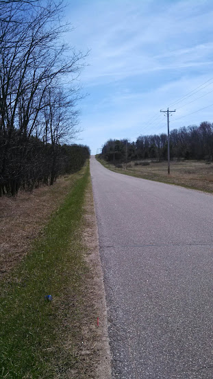
This was the worst part of the trail. 2.7 miles of paved road. The Tree Farm to the left was ADAMANT that no one tresspass in it's land. Shame, because it would have been super easy for them to run the trail parallel to the road, and at least give me a bit of shade. I think this is the part of the walk that was hardest on my feet, and what would wind up screwing me over for the last leg of the trip. I can't decide what was worst, that there was nowhere to stop and rest (all private property), or that my feet got all ground up by the hard asphalt and gravel. About halfway there IS a little shade, but nowhere to sit. Did I mention I would have liked to stop and sit? Because I woulda loved to sit. Love my camelbak though. Soooo glad I had that.

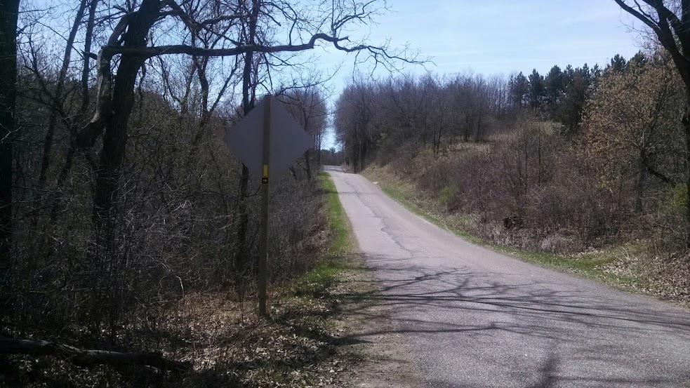
Finally! Something that wasn't road!


Approaching Highway 54, we go left into a farmer's field, and walk along the line of irrigation equipment there. Beware of gopher holes because there are a network of marmot tunnels here big enough in places to take my entire leg and have room for whatever rodent burrowed them to climb up it and into the field. I wanted to make the treeline across the field before I stopped to change socks, but about halfway across, I noticed my boot had come untied. I took this for a prompt to stop. But, shitty luck prevailed. Literally. I was about to sling off my pack and set it down when I spotted some dog doo right where I was going to set it. Moved about 10 yards down, and wouldn't you know it? the exact same sequence replayed itsself. It was almost a glitch in the matrix.

Third time was a charm and either there was no poo, or I sat in poo that I didn't see. Traded one pair of socks for the other and started on my chocolate brownie Clif bar. It wasn't long until the trail brought me to the lot along Highway 54. Technically this, was part of the waupaca river segment, though I'd be tempted to call it part of the Hartman Creek segment.

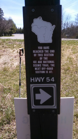
Here, a sign heralded that it was only 3 miles to the HCSP Campground. I took it as a good sign. I crossed Highway 54 and started into the final leg of my trip!

Sunday, May 3, 2015

Trail Review: Ice Age Trail Skunk and Foster Lakes Section.

For my first real National Scenic Trail outing, I was very lucky. Wisconsin is home to the Ice Age Trail, which winds it's thousand mile length across the state from Interstate State Park in the northwest, to Potawotami State Park in the east. Nearest to me, it runs into one of my favorite State Parks in the area. Wisconsin's State Parks are all pretty good in my experience (Though I'm still cross at Wausau's Rib Mountain State Park for doing away with camping.) But Hartman Creek is just the right mixture of distance, wilderness and convenience coming from Appleton. Appleton does have High Cliff, but that's being encroached upon by development and it doesn't really feel like you've gone much of anywhere. Hartman Creek, is only like 45 minutes away, but it's further outside of town (though Waupaca is still relatively nearby), feels wilder, has better swimming and more trails.

So, with familiar ground awaiting me at the end of an unfamiliar hike; and a convenient, approximately 12.5 mile segment that involved minimal roadway connections of trail leading south towards the park, it seemed like a great first proper trail outing. I had been trying to talk a couple of friends into accompanying me on this sort of trip, one of them for over a year now, but while I got a few casual expressions of interest, nobody bit seriously on the opportunity, and I decided I'd do the hike solo with a little assistance from Bob. He was amenable, he hardly needs an excuse to get out into the woods and enjoy some nature, and it seemed like my interest in backpacking had rekindled his own interests in the same.

I waited for the weather to be right, WI's been on something of a rollercoaster this spring. I hammered out the itinerary that you've already seen. And I worked up the gear inventory, though most of that was just a matter of going through what I had in my bag already. After a stop at a local convenience store for a coffee to go with my breakfast apple fritter, we set off early (by my standards) this past tuesday morning headed for the trailhead I had selected, at the north end of the Skunk and Foster Lakes segment. It was unusual, the official Ice Age Trail Association documents catalog and map the trail from northwest moving south and east. Yet most of the signage and structure of the trail I encountered seemed to assume you'd be moving north along the trail, coming from the south. We dropped me off in one of those field-access-driveways for a farmer's field across from the Skunk and Foster Lakes trailhead, because the parking lot for that segment was at the south end of the trail.

Skunk and Foster Lakes Northern Trailhead


I am not normally a breakfast person, or a morning person for that matter. But I was alert and in high spirits as I started the trail. The coffee I had probably wasn't even necessary.While I began the walk with my Polar Fleece jacket on, it really wasn't long at all before I paused, stowing that in my bag. We'd figured this would be the case, but it was only in the mid 50F range as I set out, and I wanted some warmth to tide me over till I was making plenty of my own. That wouldn't take long. Though loaded down with supplies, water and gear, my pack's weight soon became unnoticed. I attribute this in part to having such an excellent fit with my pack, and in part to human adaptability.The trail through here was in pretty good shape, only a few dead trees had fallen across it's path. The segment was hillier than I had expected, even though I'd looked at a topographical map. Numbers and shading on paper don't really translate super well to what you actually experience.

The horseshoe shaped loop I started in wound past several lakes, taking me up and down hills, and eventually on a path down between two lakes. If this hadn't been the start of my day, it would have been possible, though not necessarily ideal, to filter water from these lakes. The main reasons why I wouldn't be eager to is that they're mucky bottomed lakes and to get to water deep enough to filter from, I'd probably have to go barefoot and wade in. Not enticing in the Wisconsin spring. Having to deal with feet covered in cold mud would not be conducive towards making miles on the trail. Fortunately I was loaded with ample water (which probably made for a good deal of the weight I was lugging.) Two one-liter bottles of nicolet artesian water from the grocery store rode in my bottle holsters, and my pack's hydration sleeve had my 50oz (1.5l) camelbak. All told, I was carrying just roughly under a gallon of water with me.

The Horseshoe through the Skunk and Foster Lakes eventually took me over a little bridge and at this point, I could have taken a blue-blazed side trail to the parking lot. I actually thought from the map, that the lot would be where I exited. I'd have been better off exiting there, but I wanted to stick to the yellow-blazed main trail indicatiors, so I followed the trail across the bridge, and down a mostly vestigial jaunt through the woods. In many ways, this was a bridge to nowhere, and it added empty yards to the distance of my hike, for it soon spat me out at a road. I was uncertain which way to head, and rapidly became glad that I had stashed my new compass and a second copy of my map in the almost vestigial pockets of my hip belt. While I would certainly still appreciate larger pockets on my belt, I am forced to upgrade my opinion of them slightly. They are exactly the right size to hold my compass and map. I would not be unhappy if they suddenly accommodated more, but I no longer see them as ENTIRELY useless.

After getting my bearings and reckoning how the map translated to reality, I went left along the road, towards a nearby intersection. The parking lot would have led me more directly to this intersection, but it was too late for that. I started down Indian Valley road, and checked the map a couple times to make sure I was headed the right way. The woods flanking the road gave way to open fields, and there was some manner of home, you could possibly even call it a farm, though if it was, they must have had horses, rather than crops. Passing this place became the first eerie moment of my journey. I heard a noise that words can not really do justice. It was part baying hound, part dying moose, and yet, not really exactly like either of those things. I quoted a line from one of my favorite Radio Plays "The House in Cypress Canyon" and muttered "Some Tomcat!" (in the radio play, a young couple moves into a house and begins hearing a strange animal cry from outside. The husband supposes it must be a Tomcat in the brush, but then it grows louder). Then, as I move along the road, keeping an eye out for the next trailhead, I hear it again. Keeping my trekking poles at the ready, I increase my pace as this cry periodically issues from the woods behind me and to my right.

Indian Valley Rd, right about where I heard the noise


I reentered the wilder parts of the trail. This time, rather than a state natural area, I found myself on private property. Note those microwave towers in the above photo of Indian Valley Rd. I had the urge to put some ground between that odd howl(which to my dismay had grown louder as I approached the trailhead, though still from the same direction it had originated) and myself so I did not dawdle through the woods here. Unfortunately, as you can see from the above photo, there's a bit of a rise here, and the trail goes right up it. Making haste through the woods, I pushed myself a little too hard on the incline and quickly redlined myself. I had made it to the top of the rise however, and I took my first break, laying down on the ground, head against my pack while I rehydrated and caught my breath. I'd made it through the woods to a clearing though. Home to the aforementioned microwave towers.

I heard no further howls, no slavering beast upon my heels. But with my breath caught and the sound of some tractor or construction equipment operating near by to ruin the peace and quiet, I moved along. As I descended the other side of the rise, glad for my poles to steady my descent, I did see a bit of bone. Some manner of hip bone fragment, though I am nowhere near qualified to identify the source. Some unfortunate animal? a crumb left by the Beast of Indian Valley Road? Who can say? I moved onwards.

The trail descended further, through some more trees, past a trailer, and to a road crossing lined with boulders. Continued on the other side of the road, the end of the Skunk and Foster Lakes segment wound through some of the most poorly demarcated trails in the area I hiked that day. For a time, the trail was less an obvious path, and more a series of trees bearing yellow blazes that I puzzled my way along. Around here, it merged for a time with ATV trails and spat me out alongside a farmer's field. It felt a little odd, walking through this farm but I was glad that they permitted hikers to cross their land there. The trail continued through their fields, past their cows and barns, around some equipment they'd parked, across a road through two more fields, and ultimately along the railroad tracks that ran parallel to Hwy 10.

Despite not accounting very well for terrain, I was roughly on time as I crossed Hwy 10 and ended the SAFL Trail Segment. I'd thought there was going to be a parking lot on the other side of the highway where I could make some lunch. There was nothing there but a couple signs and some dry grass. I headed onwards down the connecting road, and had a cliff bar to tide me over as I began the Waupaca River segment of my hike. (To be continued!)

Highway 10, End of the Skunk and Foster Lakes segment


Follow the, follow the, follow the, follow the, follow the yellow blaze road


Wednesday, April 15, 2015

Advice/Musings: Getting outfitted for backpacking

If you're here, I'm sure you've noticed how much of what I post is about my gear. In part, this is due to the fact that I've started the blog in what is still (for Wisconsin) the off-season. In part this is also due to the fact that I am all about being well equipped. That's one thing that stuck with me from my boy scout days, is a drive for preparedness. Just ask my friends, I've got everything we need for most of our adventures. Whether it's heading north for a car camping trip, holding a LAN party, or trying our hand at EVP Recordings in an asylum graveyard I'm the guy with the gear. And while I've been researching gear, I've not only been looking out for top of the line equipment to outfit myself with, but also frugal options to try and help my friends get equipped. It's just not practical for me to bring everything the way I do in car camping, backpacking is going to require them to invest in a bit of gear.

I don't want to make that an extreme burden though.  You can invest any given sum of money and then some in gear like this. But you don't have to to have a great time in the wilderness. With a combination of savvy shopping and a bit of research you can build nearly your entire kit for a little more than I invested in a backpack. I went with a high end Gregory Baltoro 65. The 2014 version is what I bought, but the 2015 version sounds even better. And they're great packs, but you don't need all the bells and whistles. You can get a closeout Jansport Katahdin 50 liter or 60 liter for way less. And I've handled the 50L at fleet farm, it's a decent pack for the price. CampSaver has them too! a 50L pack means having to think a little more carefully about your gear, but it'll help you keep things light. There are some interesting military surplus packs, and inexpensive external frame packs out there too. The most important thing with your pack is to try it on, try it with a load in it, and make sure it fits YOU.

Rather than a MSR Pocket Rocket you can go with the $6 Cannister Stove I reviewed here. I couldn't be happier with that purchase. Or, if you want to go extremely frugal/hardcore/lightweight, there's always the Cat Can Stove. If you're one of my friends reading this, I know several of you already have cats. And those of you who don't have cats also know the ones who DO have cats. So there should be cans available. I might have to see about getting some cans and trying my hand at this.

Instead of going with a MSR Sweetwater Purification system, most through hikers seem to rely on the Sawyer Mini. Those who don't mind the taste of iodine or other treatment chemicals can get by even cheaper and lighter with Portable Aqua or Aquamira. Really wouldn't be all that big a burden to bring both a mini and some purification drops/tabs.

I LOVE my Titanium Pot more each time I use it. But it's far from the only option. This GSI Pot/Mug was on my radar before I went with the titanium pot. It's a little smaller so some of the recipes, like the Knorr Rice sides I've been doing might need to be adjusted, or cooked in two batches, but it's a perfectly serviceable size for doing something like boiling water for a mountain house meal, or making hot chocolate at the end of the day.

Sleeping-wise, if you can find a Kelty Cosmic Down 20 for $160 or less (and with closeouts on 2014 models, that's entirely feasible. If you've got one like we do at the Fox River Mall, check Scheel's Sports to see if they have any left. Anyhow, if you can find a deal like that, it's going to be hard to beat. This is going to be more important for camping in the "shoulder" seasons or in terrain where you can expect varying temperatures. If you're going places where you don't expect the temperature to get down below 40 degrees at night, you might be able to get away with nothing more than a Polar Fleece Sleeping Bag. I spent the night at Flint Ridge in one, and it got down into the 40s. With the tarp coocoon around my hammock, I was toasty warm all night! Just make sure to get a closed cell foam pad like this or the sort that you can buy at wal-mart for $10 to insulate you from the ground.

Shelter-wise, I've already spoken on the dangers of buying a cheap hammock but entirely affordable options still exist there. You can also get some rather inexpensive one person tents. I can't make any particular recommendations in this area but...

I've been reading other gear lists and blogs like this $300 Gear Challenge and this lytw8 gear list which echo some of the things I've already said, and provide some good suggestions/starting points for sundries that I haven't covered. Depending on what route you're willing to go, there are a variety of solutions available. Want trekking poles without spending trekking pole money? Grab some garage sale ski poles and a roll of hockey tape (or similar) to improve the grip. Don't want to spend $100+ on a tent? Try a tarp and a dropcloth.

Gear is great, and gear that works for you, is one of the best things. But people have been surviving in the wild with far less than what I've been detailing here for a long time. There's no reason you can't get out there and be comfortable on the cheap.