Showing posts with label Ice Age Trail. Show all posts

Wednesday, April 20, 2016

Run For the Harrison Hills! (Harrison Hills II, Part A)

Memorial Day 2015, the southern half of the Harrison Hills segment of the Ice Age Trail proved to be a grueling beast of a journey. Beautiful country, rolling terrain, and a practically biblical plague of wood ticks would test the patience, endurance and sanity of myself and my father who joined me on the hike. DEET Proved entirely ineffective at dissuading the little devils, and even our most thorough delousing had us picking surprise hitchhikers off our selves and our gear for weeks. Would not recommend. Didn't even wind up camping as we had originally planned.

So, of course, we had to go back. Masochism and refusal to let the segment win over us. But, this time we would approach Lookout Mountain from the North end. And we would bring with us reinforcements.  Joining Bob and I, this time, were Kevin and Nick. Kevin I've known for years, and lives in the area. Nick lives just over the border in Minnesota, and is part of an online community where I was discussing the hike, and managed to entice him into joining us. 

Preparations would begin far in advance, outfitting Kevin and Nick with the supplies that would help them on our journey. Kevin obtained a REI Traverse 70 backpack after test-driving several in the store, while Nick would wind up borrowing a spare external frame backpack we had. Both tried the Vasque Breeze boots whose praises I just cannot stop singing, and purchased a pair of their own. Same with the Snow Peak 900 Titanium Pot and my beloved $6 Cannister Stove. Kevin and I did a shakedown and hike cooking test at High Cliff State Park, and we really do need to get out there and hike more, get in better shape for our next outings. Nick too, got out more often, braving the early spring weather to make sure he was ready for the trek.

Day of the hike, Kevin drove up to Appleton to join Bob and I, and then Bob drove us to Merrill WI, where we linked up with Nick. From Merrill, we proceeded to County Highway B, to drop off extra water at our lunch site, and then from there, to the trailhead where we would begin. Nick packed up his borrowed pack, we sprayed on some permethrin to discourage the ticks, adjusted our packs, and we were off!

In the days approaching our hike, Northern Wisconsin DID see a few inches of snow, and some of it remained on the shadowy sides of hills, or on the trails, and I believe this was a boon to us, suppressing many of the ticks we may have otherwise encountered. I think the Permethrin also helped, because the gorgeous weather we had that day would drive temperatures above 60 degrees. The first leg of our trip was a rather simple one, navigationally there were simply a few turns at which other roads, or ATV trails, or alternate hiking routes converged with the Ice Age, and you just had to make sure you followed the yellow blazes. There were no sections of trail without an obvious path, and there were no connecting roads. The atmosphere was nearly one of fall, the ground still blanketed with fallen leaves, and the trees still bare of leaf due to how early in the spring it was. In motion, I had absolutely no need for my fleece, and soon had the sleeves of my shirt rolled above my elbows. The only obstacles we faced were minor hills, a few fallen trees across the path, and a picturesque stream swollen with spring meltwater, that obscured the blocks meant to be used in it's crossing. Bob and Kevin chose a wiser route than Nick and I did, but all four of us navigated, dry, across that obstacle and to the other shore.

It was not long before we reached camp, and we would take a short break there, at Chain Lake. Then, we searched the hills nearby for suitable locations to place our tents. The terrain was nice for the firepit, which sits beside the lake, but it was difficult to find sufficiently flat ground on which to pitch tents. Kevin made what seemed one of the smarter moves, and utilized my Xada hammock for his lodgings, while I pitched my REI Passage 2 nearby. Nick and Bob also had tents. I think, if I go back, I'm more likely to spend the night in my ENO Singlenest Hammock, which will be far more comfortable than the lumpy patch of ground that I fit my tent into. Lighter to carry as well. Once camp was established and we were refreshed, we hit the trail once more. 

From camp, we proceeded down the Ice Age Trail, maps of the area indicated that we would pass what was, or possibly still is, some manner of ski hill. As we rounded the other end of Chain Lake, we would cross a feed stream twice, pausing in between crossings to ponder some scat (we decided it was likely bobcat or coyote, we could have made a case for either) and scale a hill, at the top of which we found an unusual asphalt slab and stop because I forgot to take my Aleve. Pondering the purpose of the slab, we decided that it must have been related to the ski hill. The course of the trail took us around the hill and we never really saw where exactly the skiing occurred. At least I couldn't tell. I would be interested in going back just to explore that area in greater detail, but we had miles to conquer, and so we moved onwards. 

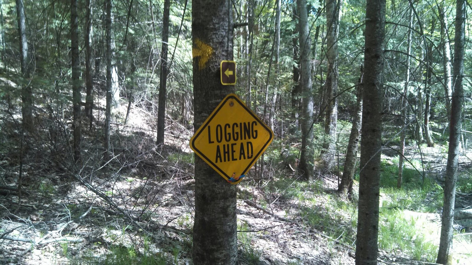
Beyond the Ski Hill was an area that I can really only refer to as the Logging Blight. I don't think we took many photos of it, it wasn't that picturesque. This was a zone of both old and new logging, which bared the hills upon which most of our course took us, and below us, in the valleys, lay marshes and bogs. We could see some watery attempts to either drain or navigate these valleys, some manner of road or shallow ditch, but the terrain was very reluctant to relinquish any part of itsself to man's design. It was around now, that the away team began to concoct stories of the local bog witch, who would surely crack our bones for marrow and sink us within the moist fens of her turf.  We were still encountering snow at this stage of the trip, though less of it where the canopy was stripped away. 

Hunger began to set in as we trooped through the blight, and we began to wonder when we would reach our designated lunch spot. I was about to say that we should just stop at the next clearing that looked suitable, and make our meals there, but a quick consultation with the app Nick was using to map our journey indicated that we were less than a quarter mile from the appointed lunch site. Mustering our reserves, we pushed on ahead and were soon rewarded with sight of County Highway B, and the ATV shelter at which we would cook our lunch.

To be continued...

Thursday, May 28, 2015

Post Trip: Harrison Hills Part 4

Our flight from the mountain was not swift. Not on the whole. We made relatively good time in the downhill section of the trail, refreshed from our break atop the mountain. But we were low on water and we knew it. and downhill does not equal easy. if anything it's a greater challenge in terms of balance, your load wants to pitch you forward and you need to stay in control. Still, we made admirable time from the mountain, down to the meadow we might have stayed in. But by then we were steeled against staying, and moved onwards. As we continued, we kept waiting to reach "bumblebee" lake again. Surely it was just around the next bend, just past this next hill... But it didn't turn up. and it didn't turn up, and each step we took without seeing it made us gladder and gladder that we didn't decide to stay.

It turned out to be over a mile away, as the trail lies. I checked, afterwards on google. We would have walked a mile out, and a mile back for water, and been dead exhausted from it. As it was, my filter didn't like something in the water. It started spraying out the pressure release port, rather than pumping properly. I scrubbed, pretty vigorously, with the included brush. Rinsed it out. tried pumping again, and we only managed another liter or so before it began spraying again. Mind you, this was WITH the prefilter I'd bought. I was fairly displeased. I don't know if the lakes are full of ancient glacial silt or what. Best theory I have is that the slime from Bus Lake's weeds is responsible. I'm going to need to put that filter through it's paces and evaluate whether I want to keep it after all. I think the worst part of all, was how frustrating it was while I was exhausted.

We figured we had enough water, at this point, to reach the car. I'd managed to wolf down a Clif bar before pumping, and that kept me from crashing completely, but my muscles were nearing their limits. It was most noticeable from my left leg. My bad leg. a 2008 ski crash left three titanium pins and a plate in my tibia, and I don't know how to keep myself from subconciously favoring the leg. As a result, my left leg is weaker than the right. I was relying heavily on my ski poles, sometimes cantering with left leg, right pole, right leg left pole motions, and other times I was bounding like a gorilla, slamming the poles in place as one, and heaving myself past them on the strength of my arms. I had to keep moving because the lower the sun crept, the further we went, the worse the bugs got. But more than once as I reached the top of a hill, I'd feel the ascent take it's toll on my legs, and had I not had my trekking poles for support, I'd not have stayed upright. At least twice, my left leg wobbled and threatened to fail utterly.

At some point, crossing a fallen tree I nearly twisted my ankle. And here's why you'll NEVER sell me on going with lightweight trailrunners as some of the toothbrush drilling elite prefer. My left foot came down weird, on uneven terrain and the ankle began to roll. My trekking poles steadied me as I lurched forward, but without them, and without the ankle support of my vasque breezes, I KNOW I would have completely rolled, possibly broken it. But With my poles to catch me, and while my boots won't stop it completely, they impeded the roll, making it less severe.

Those last two miles were hell. I was SO glad I failed to talk anyone into joining us on this trip, had I done so, that would be the last trip they would ever agree to take with me I am sure. Bob and I both went quiet, lost in pain and morale depleted. We no longer chatted, we no longer even swore at the inclines. The most you got from me at the sight of the next climb was a pained whimper. I wanted SO badly to just lay down and cover my face with my hat and REST, but I couldn't. if I lay in the brush I'm sure the ticks would have carried me off to their lair.

Returning to the car, we checked ourselves for hitchhikers, stowed our gear, rehydrated from the supply we had there, and made for culvers. I purchased a feast of meats to sate the fierce hunger I had worked up on the trail. I even allowed myself a Dr Pepper. That sweet nectar, rich in caffeine and sugar reinvigorated me incredibly. I began to feel some semblance of human. Had I been able to tap into the food cache on my back, devour a lara bar or two, I might have stayed in higher spirits or been clearer headed.

I don't regret doing the hike. I intend to go back. I do regret waiting till this late in the season to go. I do intend to go earlier in the year. I'm also going to try coating my clothes in permethrin, see if that's a more effective anti-insect measure. And when I go back there, I'm going to find some way, concoct some liquid elixir to subsist on during my climbs/descents. Something to keep me energized and alert and that won't require me to stop to consume it. Get a cheap camelbak knockoff that I dont have to keep clean for water and fill it with some sugary nectar perhaps. I was considering maybe dissolving in a little caffeine and asprin too.

Wednesday, May 27, 2015

Post-trip: Harrison Hills Part 3

You would think that it'd be easier after eating some lunch. Well, nothing about this trip was easy. I hesitate to say that this was the hardest part of the trip though. I also hesitate to say that we made good time. We were ascending towards Lookout Mountain, and the terrain was very much more of the same, except growing steeper and steeper the further we got. Our path took us through more of that "young growth" area, past more lakes, across a murky crossing that reminded me of the beginning of the trip. We crossed a logging road and found a bulldozer sitting where the trail continued. Soon after, I declared a rest stop at a rather pretty lake with a bench beside it. Later, we would come back and filter here. As I've no real clue what the lake's proper name is, and there was a bumblebee buzzing around near the bench, I will refer to this lake henceforth as "Bumblebee Lake"

It got drier and steeper, significantly so after "bumblebee lake" as we headed towards Lookout Mountain. Roughly four hills from the mountain, I spotted the towers on Lookout. This gave me a slight energy boost, a good thing because increasing insect swarms prevented me from eating anything out of my food cache. There really isn't anything I can say that will properly convey the tax this section of the trail put on us. Pictures would not do it justice, so I really didn't take many at this point. Also, a desire to keep mosquitoes out of my mouth was a factor.  I point to the relative lack of pictures, in fact, as evidence of this difficulty. I'm sure there are numerous hikers out there who'd find the difficulty we had with this section amusing, and point to trails that were far rougher on them, but this was only my second such hiking expedition, and it was proving overly ambitious. I hope to reach a point where I too can laugh at these woes.

Eventually, we won out over the slopes. Dragged ourselves to the top. Found a group of ATVers who welcomed us to the peak, and expressed surprise that there's a hiking trail leading up to the top. We chatted with them and made our way to the lookout tower atop the mountain. Nearby were two towers, one Radio, one Cellular. I had infact noticed that my reception was better than I would expect in that area. The lookout tower was steel, and had a fairly sturdy feel. It's ascent was narrow, and it occurred to me that it was mildly sadistic to make the reward for scaling the hill, Another Climb!

You could see Rib Mountain from the lookout tower, off to the south. You had a pretty commanding view of the area from there infact. Looked just like it did from the video I posted earlier, which was taken on that same tower. I took a picture but it didn't turn out.

At this point, we retired to the base of the tower and began discussing our options. With all the ticks we were seeing (even there at the tower) we had little desire to stay the night. I really wanted to hear the wolves though, so I waffled. Additional bug repellent options, and earlier seasonal arrival options were discussed and it was decided we'd come back another time to hear those wolves. Initially we thought to make for Firefly Lake, seeing as we were almost all the way there (only another 30-40 minutes once we hit highway). Eventually we'd just decide no, it was too late at night, we were about 3 hours behind our inital schedule (my prior post puts us up there~ 1:10pm, and it was 4:10pm) and we hadn't eaten dinner yet... we'd be better off making for home.

Tomorrow? Our grueling trek out.

Tuesday, May 26, 2015

Post-Trip: Harrison Hills Part Two

Though the first stretch was taxing on my morale, meeting up with Bob had boosted it. He was fresh and excited to be on the trail, and this spread to me. Almost immediately I started feeling better. The terrain was getting worse though, the hills more frequent. I had planned to start eating chocolate covered peanuts (bad idea, they got melty fast) but my hands were constantly busy. I had planned on making a little better speed than we were, but the grueling constant hill climbing was taking it's toll on our progress. Still, we pushed our way in, battling the terrain until we topped a hill near Bus Lake, roughly a third of the way in.

Taking a break and digging into our snacks, we spotted a group's car-camping (ATV camping?) site on the side of the lake, but saw no trail that led down to it. I expressed a desire to filter some water, and we began talking of stopping for lunch soon. We wanted to see if we could find a trail over to that area which appeared to have good lake access, and so we continued around the lake. It led us down and away from the site we'd seen and I was beginning to think about filtering from where we were. We stopped to try and identify some object in the middle of the lake, when another Hiker hailed us.

Jim from Waupaca was 800 some miles into the trail, headed westbound to the terminus at Interstate Park. We chatted awhile, taking the opportunity to rest and learn from an IAT through-hiker. I envied his mesh bug net that encompassed his face, little did I know how badly I would want something like that before the day was through. Learned that on average he was getting something on the order of 17 miles a day, and had some support in terms of resupply from his wife. We didn't want to hold him for too long, and soon bid him adieu, continuing a little further.

A side-trail lead us onto an isthmus in the lake, and noting the relatively clean ground, comfortable shade, and pleasant, mosquito-banishing, crossbreeze off the lake we decided to have lunch here. I unpacked my supplies and began cooking a Cheesy Broccoli Rice to mix with my Salmon Packet. Bob enjoyed a sandwich he had prepared and some Cheese Nips he had packed. We finished my raisins. Looked at where I'd filter my water as I cooked. We heard the campers across the lake return and were glad that we hadn't cut over to their site after all. Lunch was delicious and foritfying, and absolutely necessary for what would come next. 

Filtering water turned out much easier with an accomplice to help hold the bottles and bag, but the water was weedy as far out as I could reach, and the weeds trapped a bit of slime in there. In my post-mortem analysis of our later adventures, I begin to suspect that this slime was in part responsible for the degredation in my filter's performance (at the worst possible time). But we pumped our fill before continuing on.

It was around this time that we noticed the Ticks. 

Attempting to hitch a ride on our boots, we found that our lunch spot had harbored some ticks that we had not expected. We executed a thorough inspection, redoubled our application of  bug spray, tucked our clothes a little more securely and continued on.

Tomorrow? Part 3: The Ascent.

Monday, May 25, 2015

Post-Trip: Harrison Hills Part One

That was grueling.

The plan, as we laid out here on the blog was certainly an ambitious one. I suspected that it wouldn't be entirely accurate, I doubted our ability to go PAST Lookout Mountain, and with good reason. While the 12 lateral miles on the map is certainly within my means, This is High Relief Terrain. and I do NOT mean we're getting a lot of rest in here.

I got dropped off at Alta Springs Rd, at the southern/western end of the trail, and even there it was a little difficult finding where to start. There was some sort of snowmobile/atv trail that faked us out. We even had a hard time finding alta springs road to begin with. But, I quickly got put on the right trail, and as Bob drove away, I started towards our meetup point. The "nice beach" that the trail guide referred to was one of the nicer spots on this segment of trail, I guess. But it wasn't much. A real disappointment after what I saw in the Waupaca River segment. There was a bench, and a nice looking bit of creek, but no sandy shore like I'd been led to expect, and it was tiny, and there was a lot of foliage encroaching.

So, this first segment? It was a swamp. And when it wasn't a swamp, it was a hill. But mostly it was a swamp. This was one of the only times this day that I would make good time. Why's that you ask? Well, being a swamp, it was full of mosquitoes. Shades of my traumatic hike on Wildcat Mountain in 2013, I could NOT stop without getting swarmed by them. This was worse, really. Wildcat only had gnats. Gnats I could have pulled my neck gaiter and shielded my mouth while I caught my breath. I could have even covered my face with my hat if I had to. Mosquitoes didn't care where they landed, they just wanted my sweet sweet juices. So, no matter how I felt, I had to keep trucking.

Then, passing through a section that had been logged maybe 10 years ago, I had a stand of very dense new growth to my left, and I see this black lump way ahead at the curve. My first thought is "oh shit, a bear" and I make some noise, trying to run it off. Nope. Not a sleeping bear. No reaction. It's about 6 feet long. I approach it. It's just a black mass about the size of a body. I poke it, hoping it's a singing hobo and not a stabbing hobo. It's neither, it's a sleeping bag. Someone has abandoned this, sans stuff sack on the trail. Somehow, this didn't make it feel less eerie. I don't know if someone lost it without knowing, or fled the mosquito swarm, abandoning it in the process, or if there's a shredded tent somewhere out there in the wilderness, missing it's sleeping bag.

So, I was glad to make good time. I started thinking about how "mosquito" has the word "quit" in it. My stomach was NOT agreeing with the steak egg and cheese bagel I'd had for breakfast. It calmed by the time I reached the Turtle Lake lot. Our original itinerary had me starting a little earlier than I began our trip (about a halfhour late) and I arrived at Turtle Lake Rd around 10am. Bob was shocked to see me, expected me closer to 11am.

One of the high points of the trip was meeting Ruby and her husband, who head the local IATA chapter and take care of the trail. We chatted with them for a little while, they'd seen us in the lot and stopped to talk. My morale went up after hearing from them that it was very likely we'd hear the wolves in the night. Also, from linking up with Bob.

In the future, I'd definitely just start the trail at Turtle Lake Rd. I didn't see anything I would dearly miss there. Skunk and Foster Lakes was DEFINITELY a better first leg of a trip than this was.